Yes. Fishing is part of what makes the Grand River so grand. We understand and appreciate that anglers have concerns about the project. Since the beginning of the project we have been working with local angling groups to share our vision and seek input from those who currently use and understand the river. Comments from angling groups have been used to inform the current design. Our goal is to make an already great fishery even better.
Will the fishing be ruined?
Our goal is to improve the quality and quantity of fishing opportunities by providing increased habitat, structure, more gravel, boulder, cobble, diverse flows and a varied river bottom. Numerous fish species would benefit including migratory fish that would hold better before moving upriver and local populations of walleye and bass would flourish. Over the past 160 years, tons of boulders have been removed and the river bottom was flattened. Often the best structure is a dangerous low head dam. The river could provide a higher quality fishing experience, like the St. Mary’s River in Sault Ste. Marie that sees an annual economic benefit of at least $7 million dollars generated from fishing. (Sault Ste. Marie Evening News; July 2, 2015).
Will anglers be able to wade the rapids?
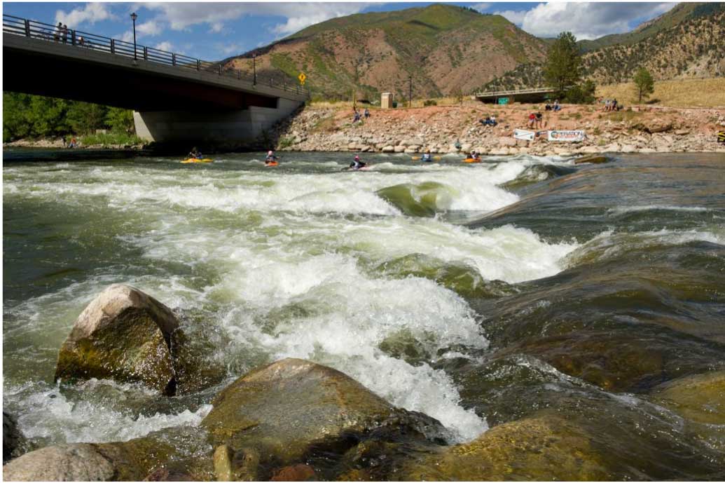
Yes. With the removal of dams, and the addition of rocks and boulders, angling would not be restricted to Sixth Street Dam but be open to wading at numerous locations in the river when flow rates are similar to existing conditions. We are working closely with the City of Grand Rapids and other project partners to provide additional access points into the river as well.
What about sturgeon? They already inhabit the river here, why do you need to ‘restore’ the rapids?
Sturgeon are culturally significant to Native Americans and they are an indicator of the river’s health. The more we learn, the more sturgeon are becoming a focal point of this project. Sturgeon restoration is a management focus across the Great Lakes and research regarding the Grand River sturgeon population has begun by a group of local and Federal partners.
Sturgeon date back 135 million years and can live for more than 100 years, reaching up to six feet in length. It is good news that there is still a small population of state-threatened sturgeon in the Grand River. However, because of the Sixth Street Dam, these historic species are unable to reach a geologically unique and expansive (historic spawning) reef of exposed limestone bedrock found between the Sixth Street Dam and Ann Street.
What about the deep deposits of toxic industrial sediment behind the Sixth Street Dam?
In 2011, GRWW and the Grand Valley Metro Council received an EPA grant to conduct sediment testing in the area between the Sixth Street Dam and Ann Street. Limited sediment was found but it was tested and deemed acceptable. Of the 45 sample points, only one returned a slightly elevated level of arsenic, a commonly found element in Michigan waterways.
In 2020, the U.S. Army Corps of engineers conducted a similar sediment sampling upstream of the Sixth Street dam. All of the results were below the limits of Michigan’s Soil Direct Contact Criteria for both residential and non-residential areas, except for two locations that exceeded the limits for arsenic.
In 2020 the City and GRWW also conducted sediment sampling behind the dams in the Lower Reach. The State requires contaminant test when sieve grain analysis is less than 90% sand, on average. For the 11 samples taken, all locations were greater than 95% sand, except 1 sample. The City and GRWW decided to have the samples tested and no concentrations of any analytes were tested that exceeded any of the established screening guidelines per the State’s guidance on Sediment Testing for Dredging Projects or any known preceding screening guidelines.
How clean is the water in the Grand River?
The quality of the water in the Grand River has been steadily improving since the City of Grand Rapids started tracking the water quality in the early 1970s. Over the past three decades, The City of Grand Rapids has successfully separated its sanitary and storm water sewers. The quality of water flowing through Grand Rapids is also influenced by upstream sources and Grand Rapids is leading by example when it comes to protecting the water quality of the Grand River.
The City of Grand Rapids and USGS are working together to monitor the water quality of the Grand River in real time. They are also working on a new system that can predict E.Coli levels in the Grand River. The State of Michigan uses E.coli bacteria in the Total Body Contact and Partial Body Contact recreational criteria as an indicator for other harmful pathogens, which is consistent with the USEPA recommendations.
Find the real-time interactive system at the City’s website: www.grandrapidsmi.gov/riverquality
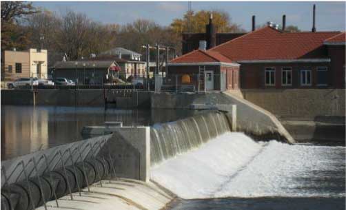
Will the Sixth Street Dam be removed completely or just lowered?
There are many river users and functions to consider. The EIS Process will consider 14 different alternatives, some of which call for the removal of the Sixth Street Dam. Design engineers and resource agency staff will be determining the best method to restore the historic rapids near the Sixth Street Dam while allowing the most benefit for all river users and the environment.
All of the dams in the Lower Reach will be functionally removed from the river and more natural hydraulic elements like riffles, runs and pools will replace the existing riverwide hydraulics created by the dams.
How will upstream property owners be affected?
An understandable concern from upstream property owners is that this project will “drain the pond” once the Sixth Street Dam is removed. As part of the 14 design alternatives that will be evaluated by the GLFC and USACE, a detailed analysis of upstream water levels will be conducted to better understand any changes. Based on the initial hydraulic analysis conducted by GRWW and our engineering firm, we don’t anticipate a significant reduction in water levels upstream of Riverside Park, however that can’t officially be determined until the GLFC selects the design of the preferred alternative for the Upper Reach and additional hydraulic modeling is complete.
Similarly, the City of Grand Rapids has been firm on their commitment to revitalize the river in a way that does not increase flood risk or create Harmful Interference as defined by EGLE as “causing an increase stage or change in the direction of flow that causes or is likely to cause: damage to property; a threat to life; pollution, impairment, or destruction of water or other natural resources.”
The accuracy of the flood modeling is of great importance to the City, GRWW, and the regulatory agencies and will be an extensive part of the regulatory review process. A permit will not be issued if a project increases flood risk.